About us
Helping businesses and organisations across Australia utilise Drone Technology
We help businesses and organisations across Australia utilise drone technology
Green Sky Group Pty Ltd is a national UAV technology company specialising in asset inspections, land surveying, data analysis, and reporting services using data captured via drones.
Our services are designed to provide clients with accurate and detailed information about their assets, land and infrastructure, enabling them to make informed decisions and optimise their operations. We leverage cutting-edge technology with a team of experienced professionals to deliver reliable and high-quality services to our clients across various industries.
Complete a New Client Form
Complete a quote request
Complete a booking request
meet our expert team
Our team are experts using all Drone Technology for asset inspections, mapping, 3D modeling and reporting. Our aerial services operate in all states and territories throughout Australia.
Jamie
CEO / Chief Remote Pilot
Alli
QLD Operations
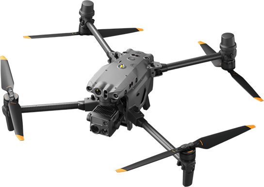
Where it all began
2017

Founded
Green Sky Photography was established on January 17, 2017 whilst our CEO Jamie Green was a Snr Facilities Manager for CBRE managing Commercial & Industrial Assets. As Green Sky begun to understand the technology and the problems drones solve throughout the industry, we steadily grew and in Oct 2022, changed the business structure from a Sole Trader to a company and Green Sky Group Pty Ltd was formed.
Our Evolution
Green Sky Group evolved from a purely Drone Photography business by keeping up with the expansive drone technology and began offering extensive and high-quality drone services such as Aerial Surveying, Mapping and 3D Modelling as well as Asset Inspections including Thermal Solar Inspections.
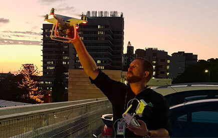
Present
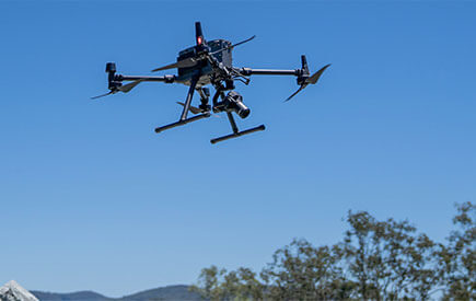
Where We Are Now
From starting out as a photography business doing small real estate jobs back in Jan 2017 to now, providing drone services nationally, Green Sky Group have a network of over 350 CASA licensed Drone pilots ready to help. Take a look around our website to see how we can help you. Then get in touch through our "Contact Us" page
 our history
Green Sky Group Pty Ltd was founded on October 1, 2022, after previously operating as a sole trader under the business name Green Sky Photography, established on January 17, 2017. The company's corporate restructuring was driven by the growing acceptance for this evolving drone technology within the industry and an increase in national work volume. The company holds CASA ReOC 6846 and is fully insured to conduct all operations outlined within the company’s CASA Certification and approved Operations Manual.
Green Sky Group offers a wide range of drone services designed to provide clients with accurate and detailed information about their assets, land and infrastructure. Our services include asset inspections, land surveying, photography, videography, data analysis, and reporting. We use drones equipped with specialised sensors and payloads to capture data which are designed to provide clients with accurate and detailed information. We work with various industries, including construction, agriculture, mining, environmental management, and real estate, and leverage cutting-edge technology and with a team of experienced professionals to deliver reliable and high-quality services.
As a national Drone technology company, we are well-equipped to meet the needs of clients across the country. Our target market and industries are building and asset managers, surveyors, construction companies, builders, insurers, engineers, marketing managers & real estate professionals.
 our mission
To integrate drone-based technologies to provide a premium service that enable people to efficiently collect high-quality data and gain valuable insights for more effective asset management and positive outcomes.
 our commitment
We are committed in providing premium Drone services to keep our clients fully informed, supported and safe. We uphold demanding quality standards for the Drone services we provide, matching the quality of our customer service. We aim to provide superior services that keep our clients fully informed, supported and safe.
drone solutions to help industries work smart and efficient
Our team of experienced professionals hold technical and specialised expertise in evolving drone technology, facilities management and engineering services. This experience helps us to understand, capture and deliver useful accurate aerial data directly to your desktop.
We are committed in providing premium drone services to keep our clients fully informed, supported and safe.
Drone Surveying? Drone Asset Inspections? Marketing & Media. We Do It All.
Book a discovery call today to see how our drones will improve your business operations.
![]() “Quick to respond and super helpful. Results speak for themselves. Thank you Green Sky Photography for such a great effort, especially with the timing demand we put on you.”
“Quick to respond and super helpful. Results speak for themselves. Thank you Green Sky Photography for such a great effort, especially with the timing demand we put on you.”
KEVIN S. | MURGON QLD
![]() “Alli and the team at Green Sky Photography went over and beyond for us. Their professionalism is second to none, that is to say we would highly recommend their services.”
“Alli and the team at Green Sky Photography went over and beyond for us. Their professionalism is second to none, that is to say we would highly recommend their services.”
MIKE C. | MURGON QLD
![]() “Jamie is a great communicator and he did a fantastic job of our drone photos. He totally anticipated our needs and delivered well and above and in a very short turnaround time. Would definitely recommend using his services..”
“Jamie is a great communicator and he did a fantastic job of our drone photos. He totally anticipated our needs and delivered well and above and in a very short turnaround time. Would definitely recommend using his services..”
HEATHER H. | ENOGGERA QLD
![]() “It has been an easy and amazing experience to work with Jamie. He was really responsive and professional. The photos are great and I highly recommend Green Sky Photography Drone Services!.”
“It has been an easy and amazing experience to work with Jamie. He was really responsive and professional. The photos are great and I highly recommend Green Sky Photography Drone Services!.”
JP M.
![]() “Jamie was a massive help when I needed to rent a drone ASAP, and his advice and guidance throughout the process came at no extra cost, all of which was extremely helpful and useful for further projects.”
“Jamie was a massive help when I needed to rent a drone ASAP, and his advice and guidance throughout the process came at no extra cost, all of which was extremely helpful and useful for further projects.”
RICHARD M
![]() “The team from Green Sky Photography were fantastic to deal with. We are a ground-penetrating radar surveying company, and we required a drone on extremely short notice to survey a job in Coober Pedy. Jamie was extremely accommodating.”
“The team from Green Sky Photography were fantastic to deal with. We are a ground-penetrating radar surveying company, and we required a drone on extremely short notice to survey a job in Coober Pedy. Jamie was extremely accommodating.”
AIDEN W
![]() “Highly recommend Green Sky Photography Drone services. The company has a reliable and well-communicated professional drone team that we always trust in their skills and professionalism. Their prices are very competitive and the outcome is very detailed and of high quality.”
“Highly recommend Green Sky Photography Drone services. The company has a reliable and well-communicated professional drone team that we always trust in their skills and professionalism. Their prices are very competitive and the outcome is very detailed and of high quality.”
NASER H
![]() “Alli & Jamie performed some beautiful and steady low flying over my property. Clear photography and footage. Lovely couple, friendly and happy to answer all my questions. Thanks guys 👌😊.”
“Alli & Jamie performed some beautiful and steady low flying over my property. Clear photography and footage. Lovely couple, friendly and happy to answer all my questions. Thanks guys 👌😊.”
KATHLEEN M
![]() “Green Sky exceeded my expectations and I would not hesitate to recommend their services. Jamie communicated well and I am pleased with the range of photos taken.”
“Green Sky exceeded my expectations and I would not hesitate to recommend their services. Jamie communicated well and I am pleased with the range of photos taken.”
BEN S
![]() “Alli and the team at Green Sky Photography went over and beyond for us. Their professionalism is second to none, that is to say we would highly recommend their services..”
“Alli and the team at Green Sky Photography went over and beyond for us. Their professionalism is second to none, that is to say we would highly recommend their services..”
MIKE C
Sign Up to our Newsletter to know more about our services
Company
Services
Follow Us
© 2017-2024 Green Sky Group Pty Ltd.
CASA ReOC 6846
All Rights Reserved
